Trimble TerraSync
Software designed for fast and efficient field GIS data collection and maintenance. Integrating all the ways you collect data-with a GNSS handheld computer, laser rangefinder, or centimeter-grade equipment-it’s a powerful system for
the collection of high-quality feature and position data for GIS update and maintenance
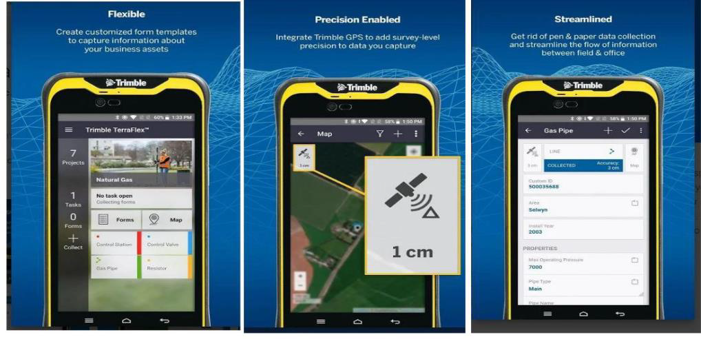
Trimble TerraFlex
New software and service platform to manage data collection activities for everyday geospatial projects. Trimble TerraFlex is a cloud subscription-based solution for mobile geospatial data collection. The software suite comprises mobile and cloud components that allow you
to collect, process, and manage your data.
Trimble Business Center
TBC has a range of tools for processing controls, running traverse adjustments, and combining all data sources including GNSS, Level and total station measurements. TBC uses Robust calculations including least squares adjustments within the processing engine to make network adjustments accurate.
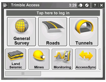
Trimble Access
Trimble Access is designed to support everyday work, including topographic surveys, staking out, control, and more. Trimble access offers an easy to use interface that will ensure your instant productivity. Feature-Rich graphical COGO routines for calculating points and features. Graphical staking of points, lines, arcs, and alignment
from active maps.
GPS Path Finder
This is a powerful and easy-to-use software package of GNSS post-processing tools, designed to develop GIS Information that is consistent, reliable, and accurate from GNSS data collected in the field.
Key Features. Differential corrections to improve the quality of GNSS data collected in the field, Quality control of GNSS data before exporting to GIS, and Sophisticated data dictionary editor to ensure consistency between the field and office.