ArcGIS for Desktop
ArcGIS for Desktop is grouped into basic, standard and advanced licensing levels. This is the primary platform for GIS professionals to compile, author, and use geographic information and knowledge.
ArcGIS for Server
ArcGIS for Server comprise of major two levels work group and enterprise both having basic, standard and advanced editions.
ArcGIS Online
Is an open data platform for maps and geographic information that allows geographic information to be delivered as simple, intelligent maps and information feeds.
ArcGIS for Mobile
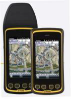
Mobile GIS enables field-based personnel to capture, store, manipulate, analyze, update and display geographic information. ArcGIS Online is available through a Public Plan (free), an Organization Plan or as a part of ELA.
ArcPad
A mobile mapping and data collection application designed for geographic information system (GIS) professionals. With advanced capabilities for creating, editing, and displaying geographic information, ArcPad gives you the power to take your GIS out in the field and the flexibility to suit your workflow.


